Sunday, May 30, 2010

May 30, 2010, Green River, Utah

After seeing the crowds yesterday when we were hiking out, we decided we needed to get an earlier start this morning. We were on the road by 5:15. Arches National Park is about 45 miles from where we are staying and it takes about an hour to get there. We headed to the Devils Garden. This trail is a little over 5 miles and goes to, among others, the Landscape Arch (106 feet high and 306 feet in width).


Landscape Arch

We took all the additional trails to Tunnel Arch, Pine Tree Arch, Partition Arch and Navajo Arch.

After Navajo Arch we kept hiking on one of the most unbelievable, amazing trails, I have ever been on. The trail is mostly on slickrock and, at times, atop ‘fins.’ We hiked on up to the Double O Arch. On the way back we stopped at Black Arch.


Fins

This is the trail to the Double O Arch!:


Mark climbing the lower O on the Double O Arch


Double O Arch


Having a snack after our hike.

On the way out of the park we passed numerous cars and RV’s. We were glad we had hiked early in the morning and were on our way out.

May 30, 2010, Arches NP-Additional Photos

Additional photos from Arches National Park.

Hiking on the 'fins':


Unusual rock wall


Tunnel Arch


Navajo Arch

May 29, 2010, Green River, Utah

May 28 – We moved to Green River, Utah and are staying at the Shady Acres RV Park.

May 29 - We drove into Arches National Park this morning and hiked the Delicate Arch Trail (3 miles round trip). Delicate Arch is 45 feet high and has a 33 foot span. It frames the La Sal Mountains. The guide books says “this is the most scenic of all the hikes in the park. It climbs slickrock slopes, passes hanging gardens and ends at a dramatic overlook of the park’s most famous rock span, Delicate Arch.”

Mark - Delicate Arch


Teri - Delicate Arch

On the way back we took a short spur trail to a Ute Indian petroglyph, believed to be from the early 1700s.

Ute Indian petroglyph

We also stopped at Balanced Rock, a short, .3 miles semiloop. The rock rises 55 feet above a pedestal that itself rises 73 feet above ground level.

Balanced Rock

Saturday, May 29, 2010

May 27, 2010, Bryce Canyon, Utah


We walked the Queen’s Garden Trail and Navajo Loop Trail this morning. The park newspaper states the Queens/Navajo combination loop is the “World’s best 3-mile hike”. We got there early and saw a couple of people on the trail but by the time we started hiking out and got close to the parking lot, it looked like a tour bus had just let everybody off!

This is a very popular trail. We came across park workers repairing retaining walls and working on the trail switchbacks.

This evening we drove up to the visitor center for the astronomy presentation given by Ranger Kevin Poe. He had put together a very elaborate power point presentation that was over an hour long. It was good but way too long. At the end the main focus was light pollution.

He had 4 telescopes set up and we were able to see Saturn and Venus. His presentation didn’t seem to include constellations but that might have been because the moon was almost full and there were a few thin clouds.

Photos: Tunnel through the Hoodoos, Queen's Garden trail, Navajo Loop.

Wednesday, May 26, 2010

May 26, 2010, Bryce Canyon, Utah


We drove to Cedar City this morning. Mark’s dad and his wife drove in from St. George, Utah. We got together to visit and have lunch.

On the way there we had planned on stopping at a couple of campgrounds. Although we knew we would be at 10,000 feet, we hadn’t planned on all the snow on the ground! The campgrounds were still closed. It’s a beautiful area, close to Brian Head Ski Resort. We passed a frozen lake called Navajo Lake.
Photos: Frozen Navajo Lake, lots of snow.

May 25, 2010, Bryce Canyon, Utah


We got up at 4:15 a.m.! Sharon and Rick picked us up about 5:00 and we drove into Bryce Canyon (Inspiration Point) to see the sun rise over the canyon. It was cold and clear!! 25 degrees!! After the sun FINALLY came up, we went to the Lodge and had breakfast and hot chocolate. We drove to Bryce Point and started hiking the Peekaboo Loop trail. It’s 5 ½ miles. It seemed like the last mile was straight up.
Photos: Waiting for sunrise, Hoodoo's on the Peekaboo Trail.

May 24, 2010, Bryce Canyon, Utah


May 24 - We woke up to 28 degrees and 1 inch of snow!! It didn’t seem too cold since the air is dry and there wasn’t any wind. Sharon and Rick picked us up and we drove to the Red Canyon Visitor Center and started walking the Golden Wall Trail. We took the Castle Bridge Trail and then ended on the Buckhorn Trail. Four hours and about 5 miles later, we ended back at the Red Canyon Visitor Center. By the time we got back to the RV, the snow had melted around the campground.
Photos: Field next to our RV, our truck, snow on the Golden Ridge Trail, Mark standing on the Castle Bridge, Sharon and Rick along the Buckhorn Trail.

Tuesday, May 25, 2010

May 23, 2010, Utah


Our friends, Sharon and Rick, flew in yesterday from the Valley.
They came by at 6:00 a.m. and we drove out to Grand Staircase-Escalante National Monument (Willis Creek). It’s a gorgeous slot canyon! It only took us about 30 minutes to get there. We hiked about 4 miles (in and out). It was awesome!

Mark had read about a place called Grosvenor Arch. It didn’t sound like it was too far, about 10 miles. The roads to both Willis Creek and Grosvenor Arch were very, very challenging!
Photos: Slot Canyon and Grosvenor Arch.

Monday, May 24, 2010

May 21-22, 2010, Bryce Canyon, Utah


May 21 – We had a long, 8 hour travel day to Bryce Canyon, Utah. We’re staying at Ruby’s RV Park.

May 22 - This morning we hiked the Arches Trail from the Losee Canyon Trailhead. It was a short 7/10 mile trail, pretty steep. A really nice trail in the red rock.

We then went to the Red Canyon Visitor Center and walked the Pink Ledges Trail and the Hoodoo Trail. The Pink Ledges Trail is an interpretive trail. One of the stops said to smell the Ponderosa pine, which we did. It smelled like butterscotch and vanilla!! We smelled several along the path!
Photos: Utah state line, Hoodoo's, Our shadows through the Hoodoos, Smelling the Ponderosa Pines.

Saturday, May 22, 2010

May 15, 2010 – May 21, 2010 - Elk Pines RV Resort, Overgaard, AZ


We got on the road and headed to Elk Pines RV Resort. The first half of the trip wasn’t bad but after we hit Globe on Hwy 77, it turned pretty wicked!! The switchbacks were unbelievable! A lot of up and down, we were losing 2000-3000 feet! The views were amazing.

We got to Elk Pines about 1:00. It’s very nice. Not a whole lot of people here and it looks like most of them are from Arizona, staying for the summer in the cool weather. We really like the campground. Our site is very wide. The weather is a little cool and very comfortable.

May 17 - We went on a wonderful 3 1/2 mile hike this morning. The Chevelon Creek Trail beyond the Woods Canyon Lake dam.

May 18 – HAPPY BIRTHDAY MARK! We went on a 6 mile hike around Willow Springs Lake. It was pretty rocky but a nice trail.

We relaxed the rest of the afternoon then went out to dinner for Mark’s birthday.

May 19 - We drove to Show Low to hike to a place called Ice Cave (Blue Ridge Cave Trail). It’s a hole in the ground that is suppose to have cold air coming out of it. We didn’t notice any cold air!

May 20 - We are officially old folks!! We played Bocce Ball for the first time!! We had a lot of fun. Everyone here at the park is super nice. We played for a couple of hours.

The weather has been fabulous! Cool mountain air. Not at all humid!

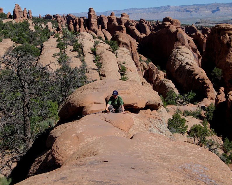
Photos: Standing on the Mogollon rim!, snow along the Woods Canyon Lake, Ice Cave.